 |
|
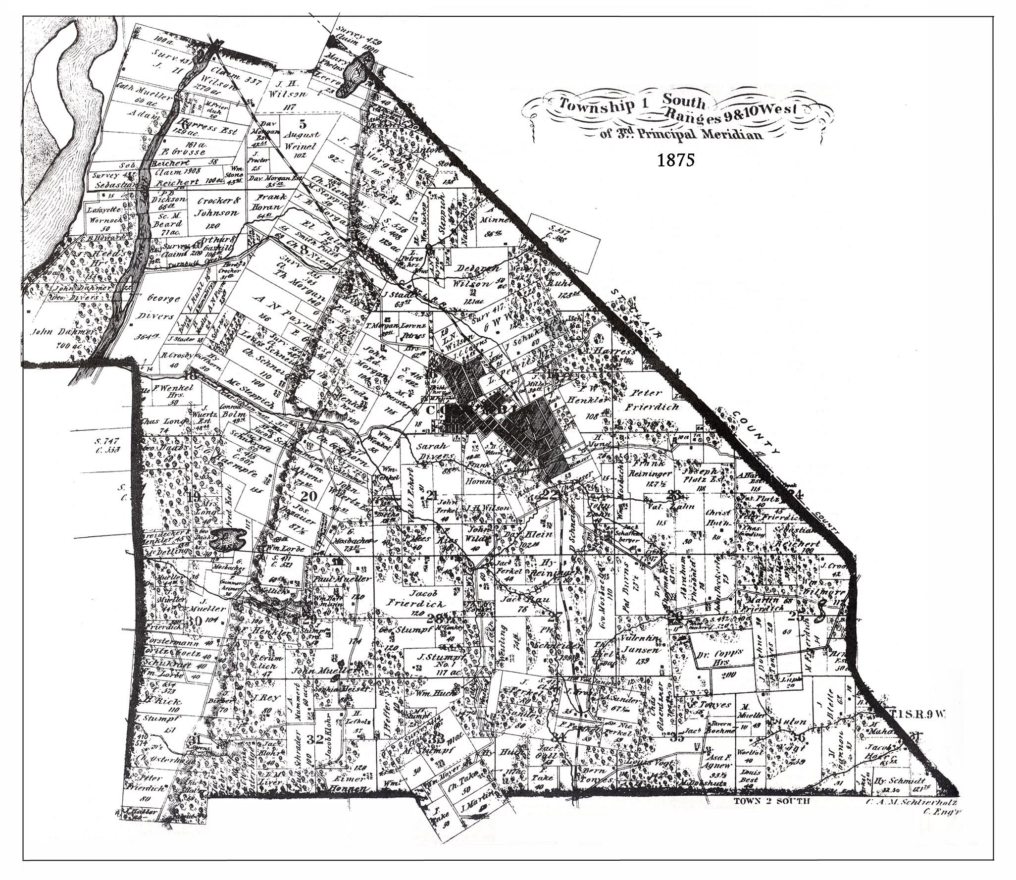
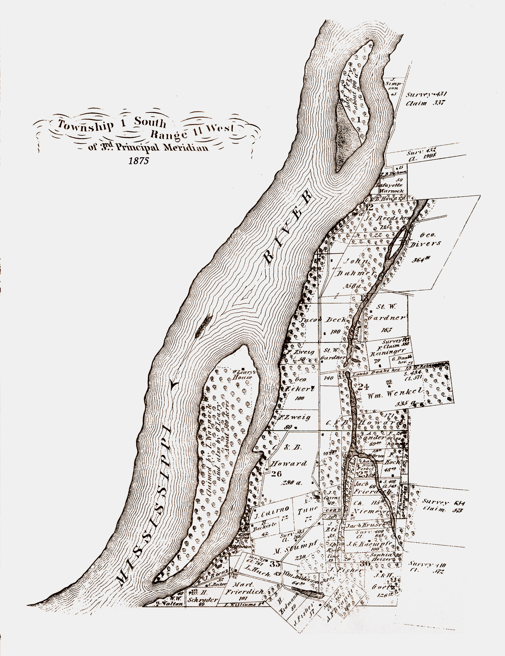
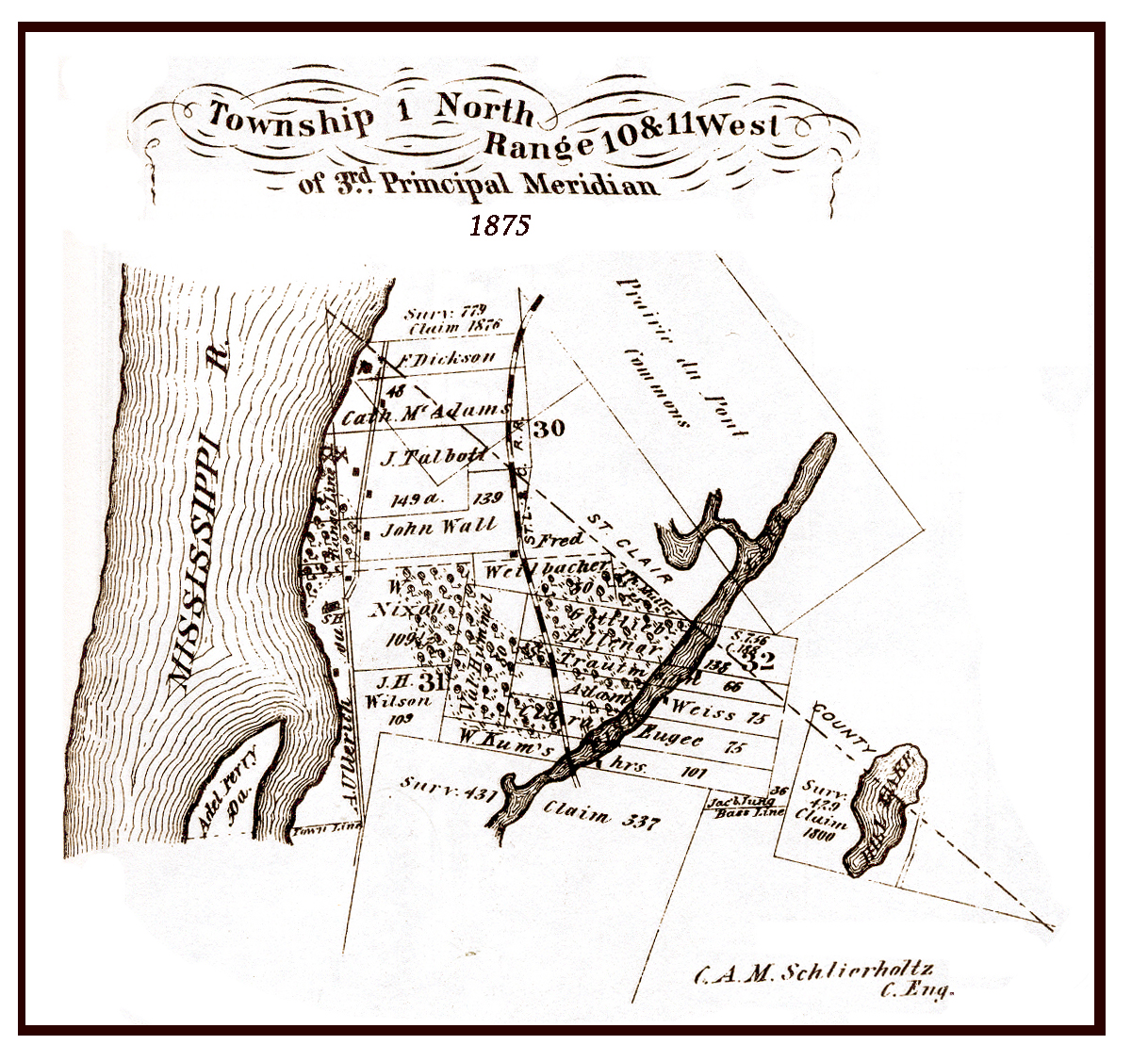
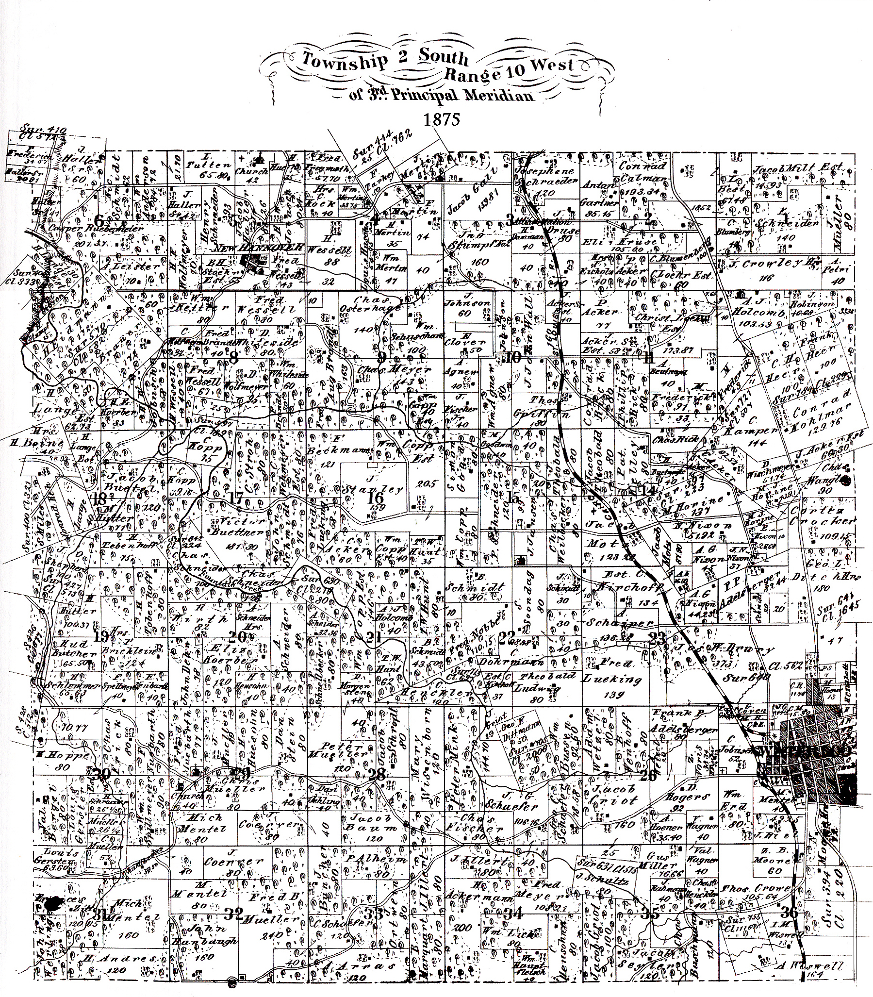
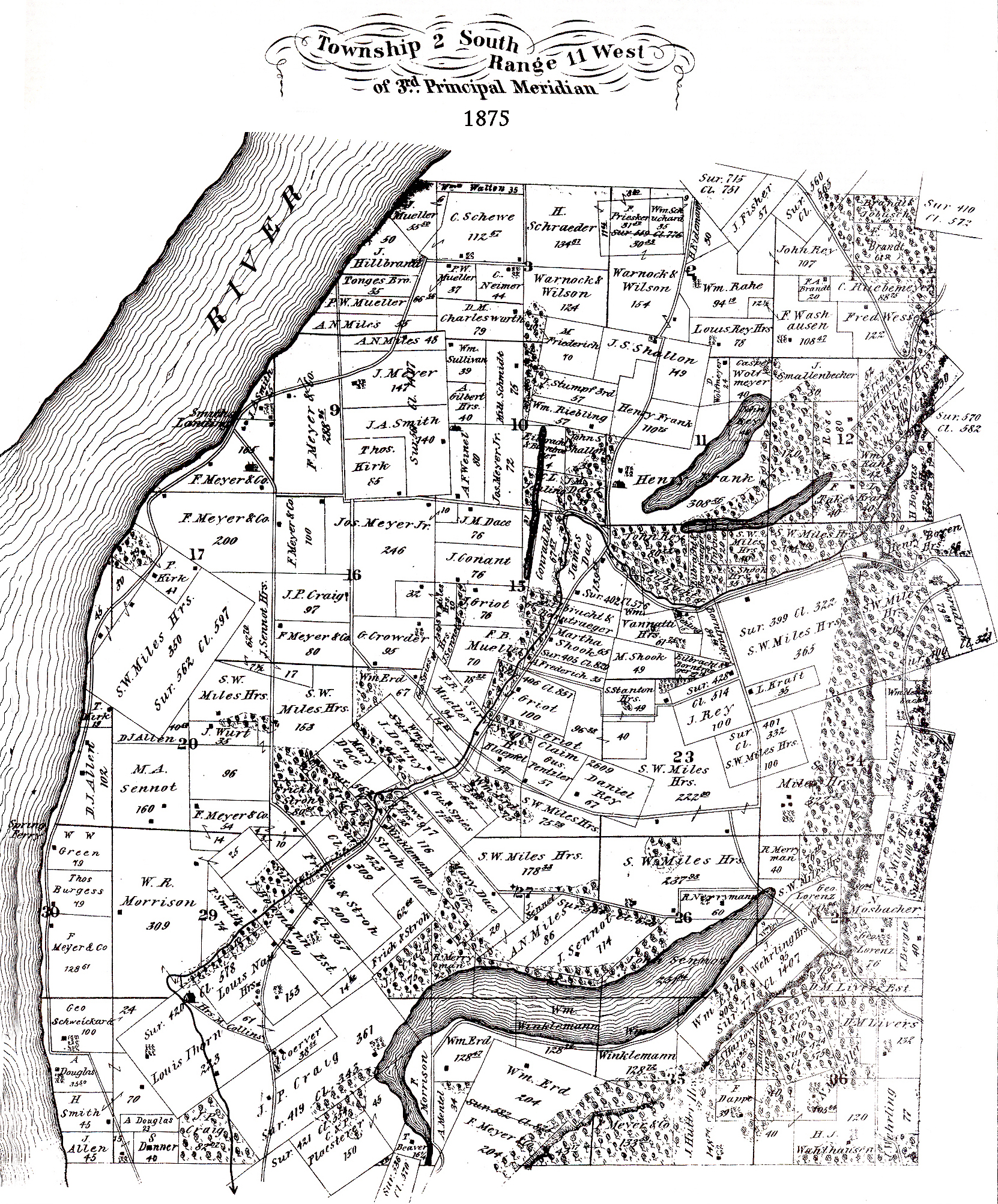
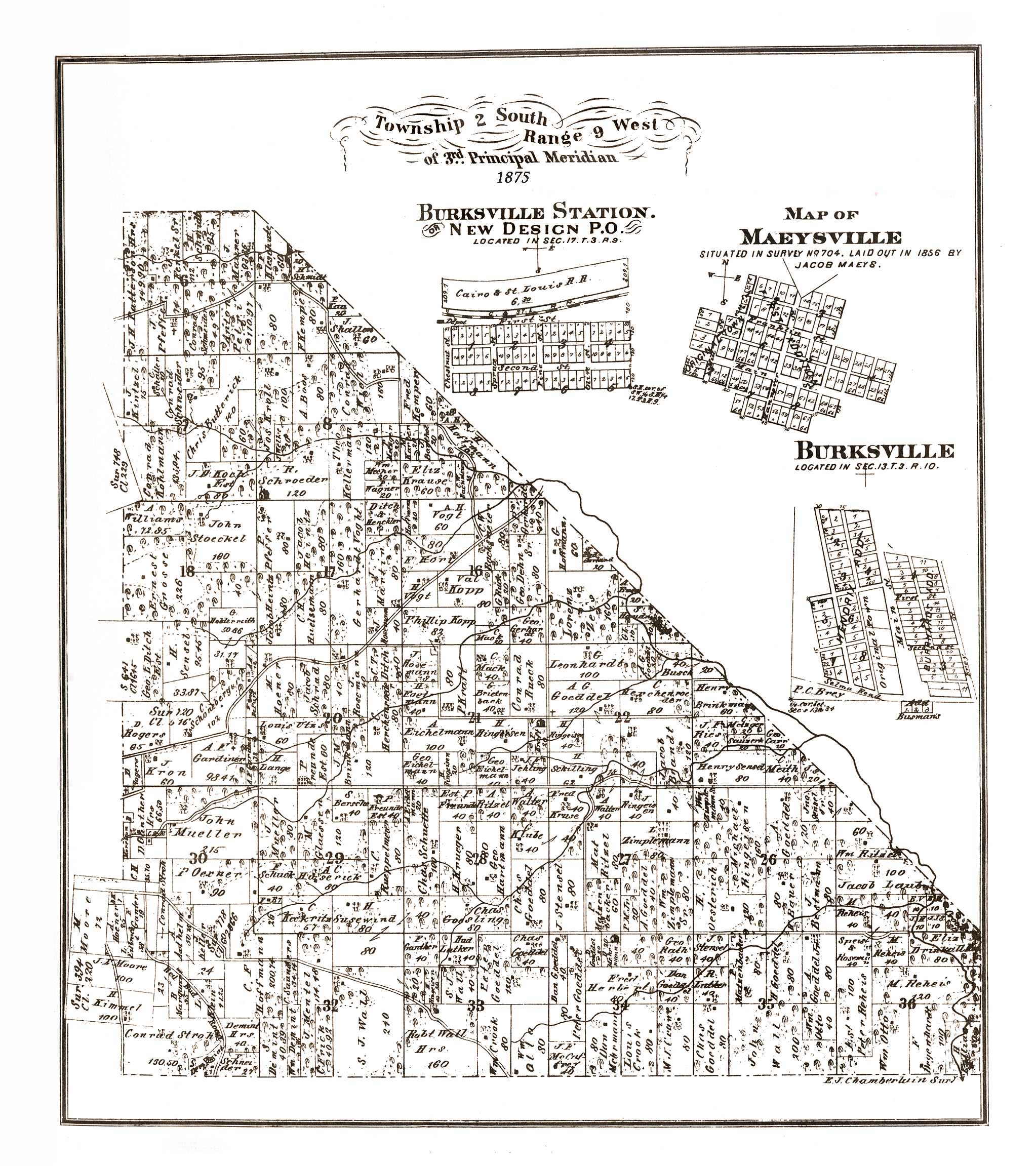
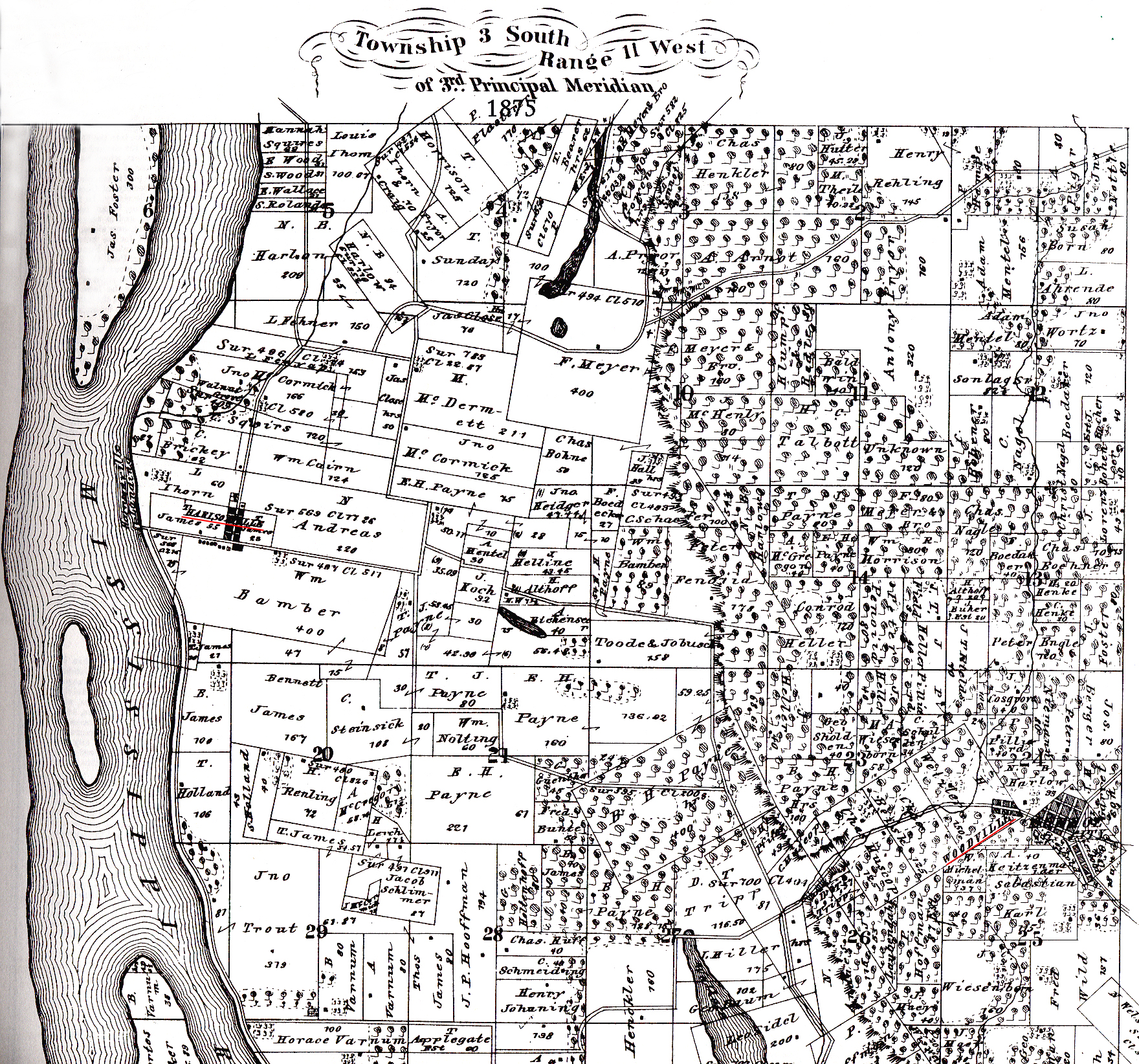
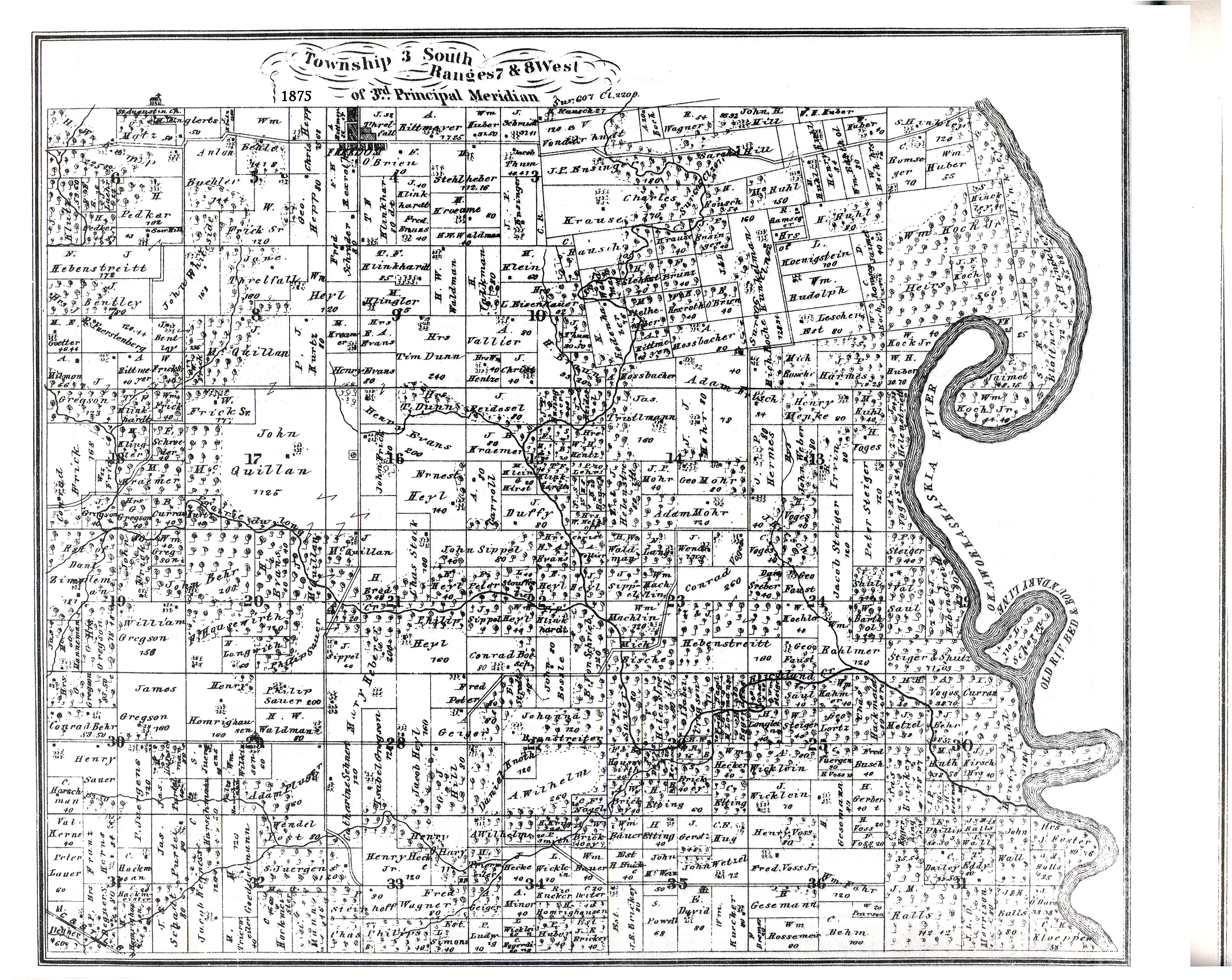
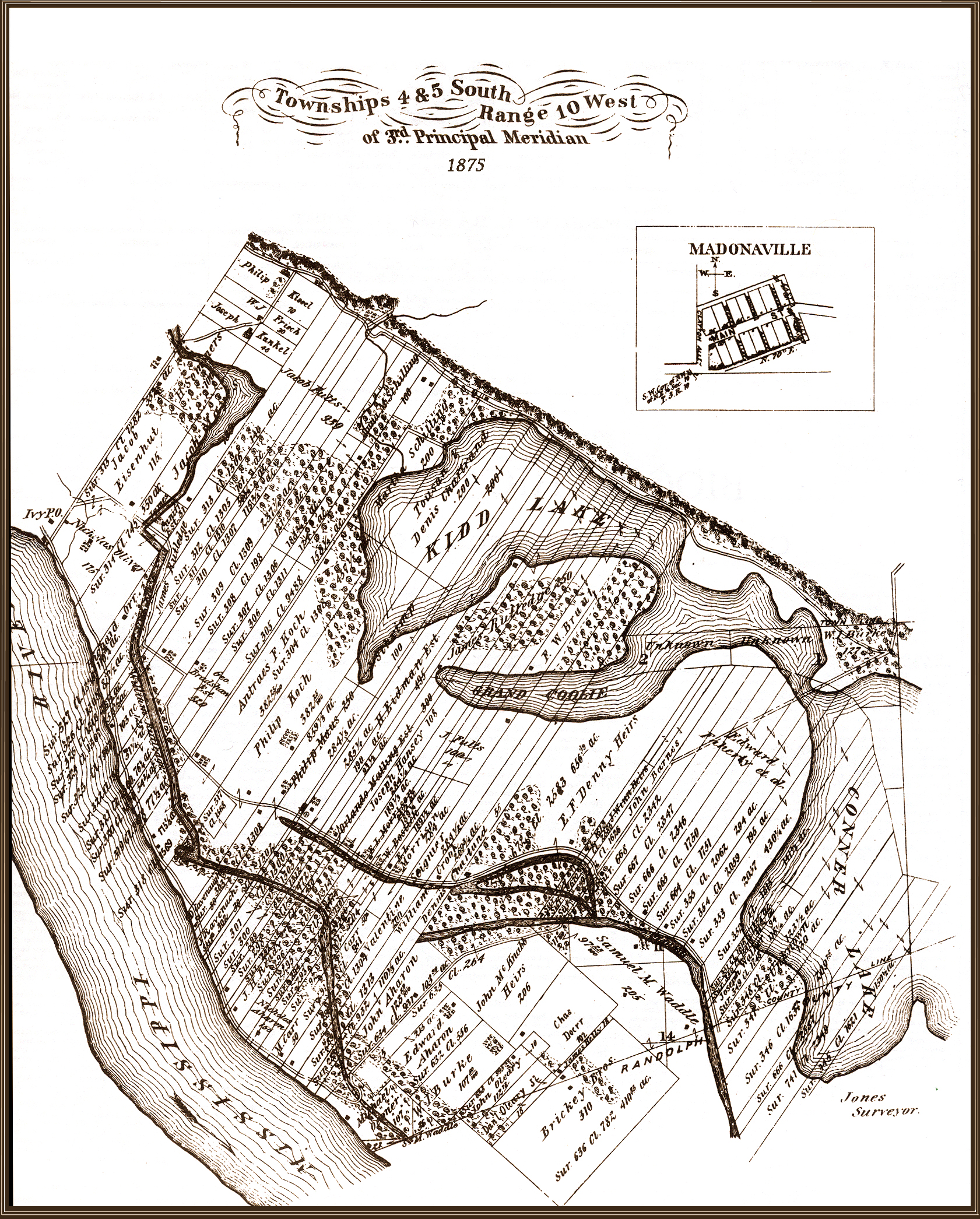
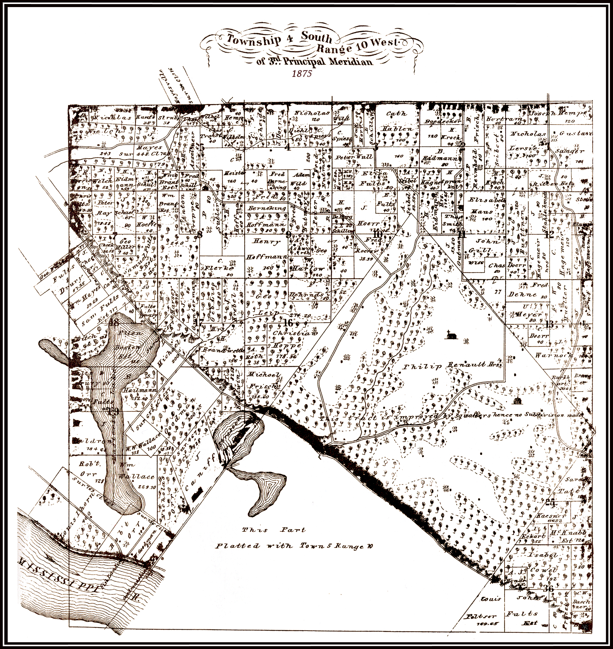
1875 MONROE COUNTY TOWNSHIP MAPS Each township is divided into 36 sections or square miles and those sections are broken into various fractions [ 1/2 section - 1/4 section - S 1/2 of the SE 1/4 of section 36 would be at the very bottom right-hand corner of a township.
Scanned and broken down by townships by Vernon Ritter. |
Click maps for larger views. Files are large so be patient.
|
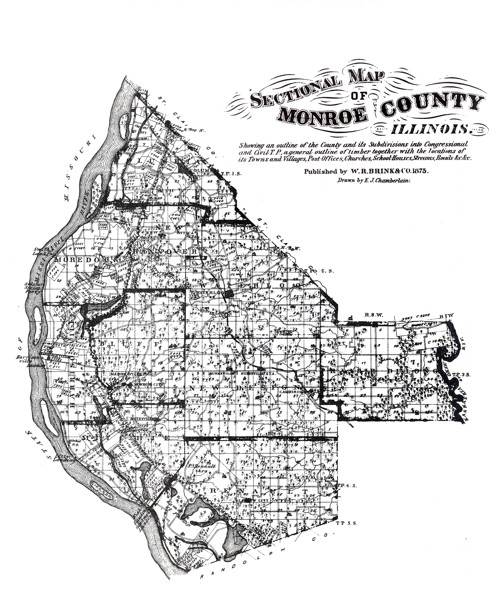
Monroe County Plat Map
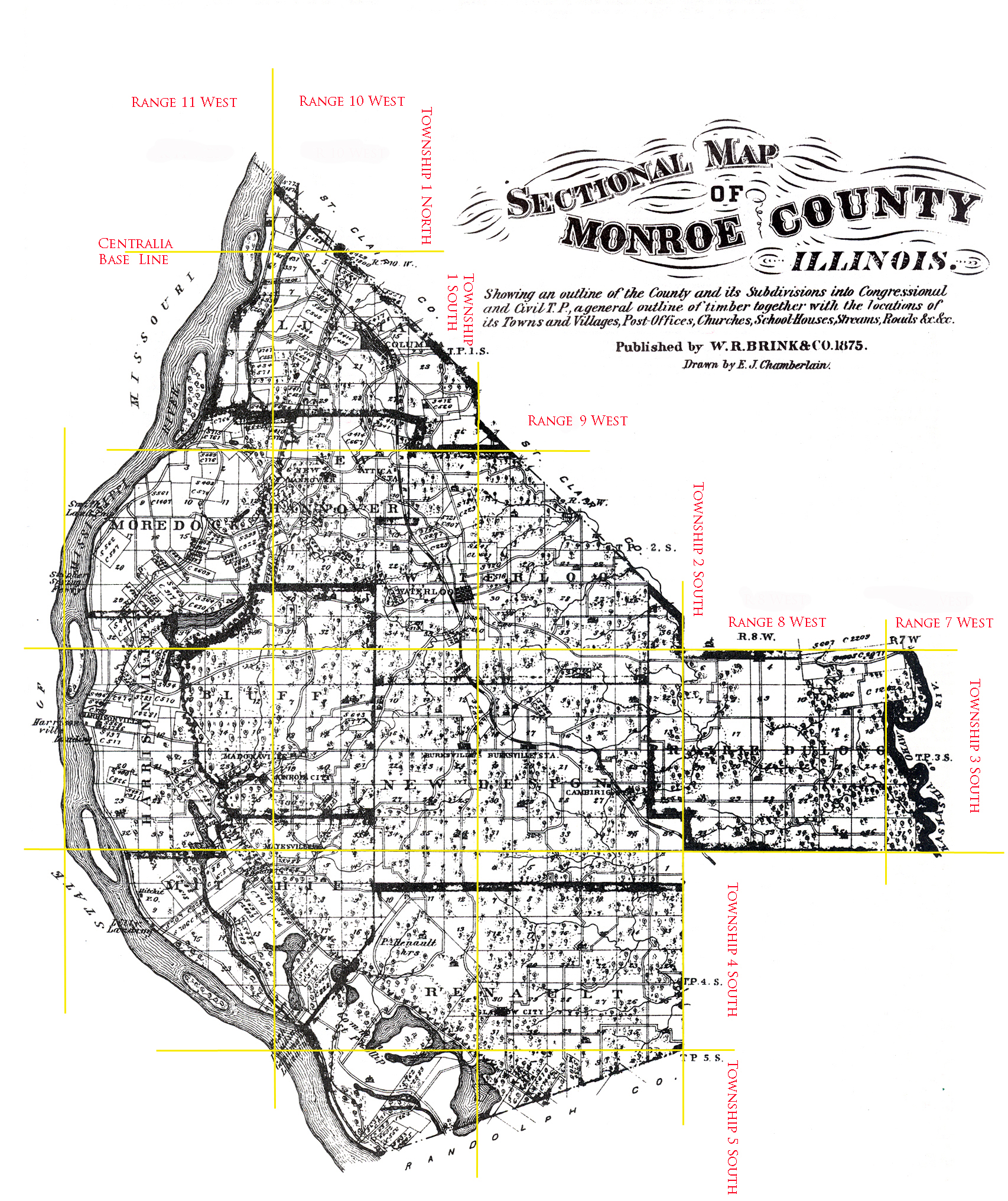 |
Same map as above except Vernon has added township lines.
To View the Township Plat Maps click the links below.
File is large so be patient.
Vernon broke the above map down in to smaller sections for easier viewing.
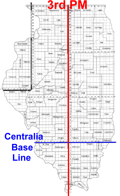
The below map shows how the townships are laid out in Illinois.
Click for larger view.